Thursday 30 November 2017

Te Araroa Day 38, Ketatahi Roadend to Whakapapa Village

Starting km: 1147
Finishing km: 1173
km covered today: 26
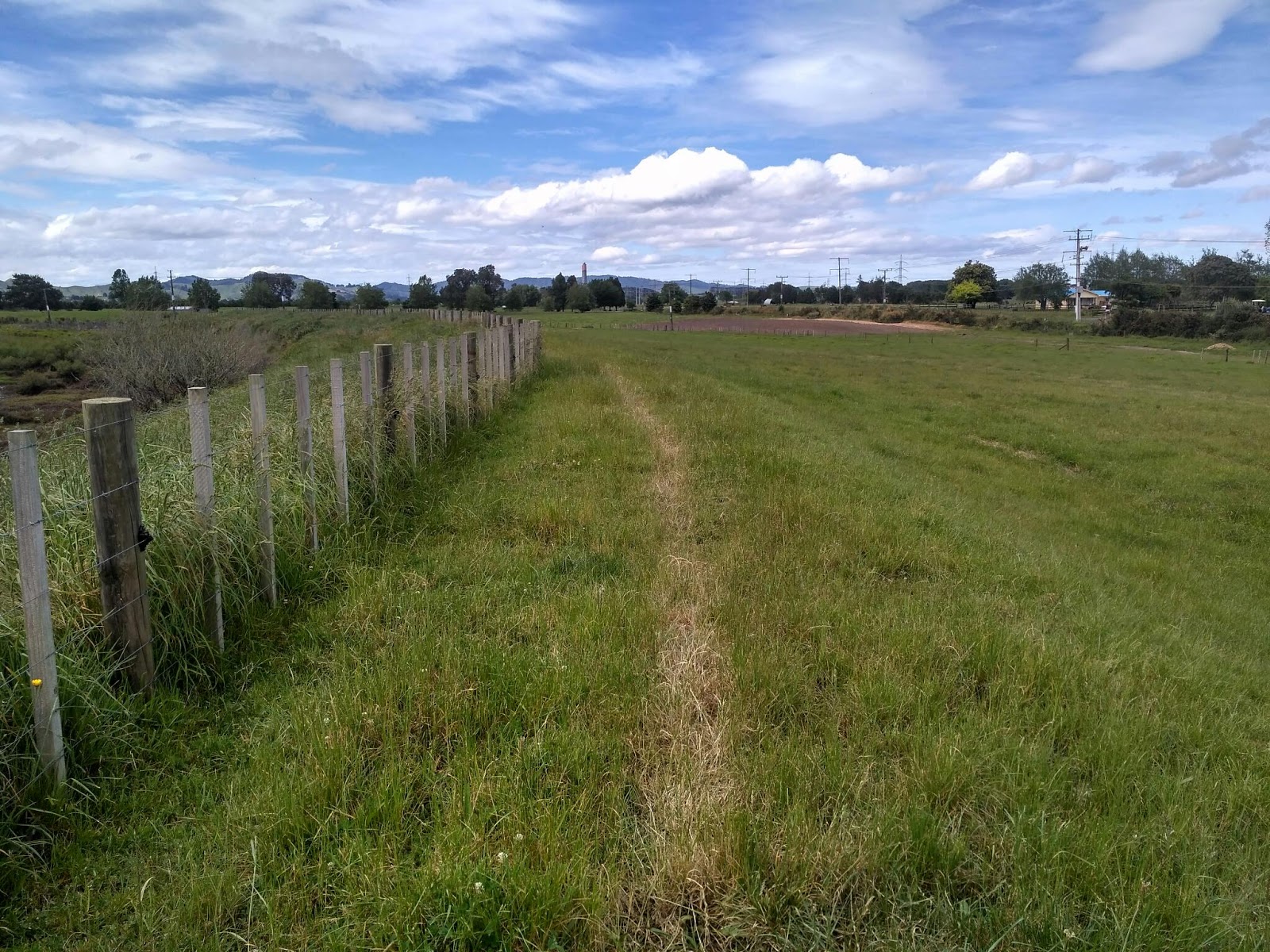
As the weather forecast for the day was much the same as for the previous few days (i.e. nice in the morning, turning dreadful in the afternoon) we planned to have the Tongariro Alpine Crossing (the first part of the day's walk) done before noon, so set out at 05:30.
I won't say too much about the crossing itself, as the photos can do a better job.
I will, however, briefly discuss our fellow walkers. 
First: There were hordes of them! We were walking the Crossing in the opposite (harder, more climbing) direction to most, so saw just about everyone doing it that day. The first appeared just after 8AM, the last (that we saw) while we were lazing about in the sun chatting with the hut warden and having lunch at 11:30 at Mangetepopo Hut at the far end of our crossing.
Second: A disturbing number of them were idiots. Almost none of the people we chatted with had looked at the weather forecast. And far too many were quite poorly prepared.  I took to asking (in as cheerful, pleasant and polite a fashion as I could) if some of the later starting walkers had warm clothes and rain gear.  Quite a few didn't, and several of these literally laughed at the question.
As it turned out the weather on the mountain did look to deteriorate rapidly after lunch, and I myself got completely soaked by a deluge in my last fifteen minutes of walking for the day as I approached Whkapapa Village.
This would have been cause for more disappointment, except for the fact that as soon as I arrived I popped up to the Skotel backpackers and booked a four bed room for myself and my fellow walkers.
Not only did we sleep inside that night, we replenished supplies (I bought a loaf of bread, some bacon and an ice cream) and had plenty of time to dry out our gear between episodes of booming, flashing and torrenting in the sky.  And grandest luxury of all, between 18:00 and 19:00 the four of us sat soaking  in our private spa pool (included with the room) listening to the rain on the roof and watching the lightning in the sky while our clean laundry was in the dryer down the hall.
100% Luxury tramping, 100% spoiled, 100% awesome.

Wednesday 29 November 2017

Te Araroa Day 37, A Small Patch of Rocky Grass Somewhere on the 42 Traverse Track to Ketatahi Roadend

Starting km: 1111
Finishing km: 1147
km covered today: 36
This day followed a similar, though not quite identical pattern to the previous one.
After rising early and doing our best to shake the rain off if our tents (thankfully it had stopped overnight) ee spent a misty, humid morning on the 42 Traverse track. It was generally in pretty good shape and easy walking and made for a pleasant start.
We got wet a bit sooner than the previous day (or at least our bottom halves did.) The Waione-Cokers Track brought us s sizeable river crossing, followed by some muddy, slippery uphills, before settling into a long flat section of large ponds of rainwater (I went up to my knees in one of these when I stepped in without probing for the bottom with my trekking pole first!)
By the time we reached the end of the W-K track the sun had burned through the must and it was almost noon, so we spread our gear out to dry while we had lunch.
This period of dryness couldn't last. The weather forecast was the same as the previous day and once again the thunderstorms found us. This time we almost had them beat, walking long SH46 and only about 30 minutes from our destination.
As it was, however we were soaked once again. And the ground was even wetter. So it was that we decided to forego our planned camping spot at a private carpark across from the Ketatahi Road and head 1km up the road to the shelter at the end (start for us) of the Tongariro Alpine Crossing.
This was a bit naughty, as you really aren't supposed to camp there. But we would be much happier and at least arguably safer spending the night there in our sleeping bags rather than having a second night in a row in sodden, mode thunderstorm erected tents. And such shelters are in place precisely to provide emergency shelter from bad weather. So that's how I rationalized that.
Once we were under the shelter it didn't take too long to dry out and warm up.  Some of our company wasn't so fortunate. Several people came down the track wet and shivering, reporting hail, sleet and even snow up on the mountain.
One poor soul was unable to contact his ride out, as his cell network had no reception. Others reported an older couple still up on the tops. As dark approached we really hoped that they'd made the decision to spend the night in the Ketatahi hut some 6km up the trail.
With light seriously fading they finally appeared, sounding thoroughly miserable but relieved to be down and headed to their car only 1km away.
With this final departure we felt comfortably alone enough to tuck up in our sleeping bags and rapidly doze off.
We were shaken out of our doze by a car approaching on the road around 20:30. A police car.  As the officer walked up to the shelter I marshalled my arguments for why it was okay.  However as it turned out, this was unnecessary. He didn't care in the slightest about our sleeping under the shelter and had just come up to check on the late couple who had been reported as possibly still stuck on the mountain. Between the lack of parked cars and our report he left satisfied and we were soon after lulled to sleep by the rain on the corrugated metal roof above us.

Tuesday 28 November 2017

Te Araroa Day 36, Tamarunui to a Small Patch of Rocky Grass Somewhere on the 42 Traverse Track

Starting km: 1074
Finishing km: 1111
km covered today: 37
You can probably gather by the title that this day ended less than fabulously.
But it didn't start that way.
We began with a 3.5km stroll out of town to our canoe hire place (conveniently located right on the trail) for our safety briefing.  Our non-Kiwi contingent was a bit confused when one of the staff asked if we had "two Canadians?" This arose because of the Kiwi linguistic oddity of calling all canoes "Canadian canoes." It's still unclear to me why the adjective is required when there are no other types of canoes in common usage in NZ, but there you go. All that said, the briefing included useful info on the canoes and the river (which, while it will doubtless be forgotten in the 5 days til we hit the river, hopefully serves as an memory jogger), fresh bread and prepared to order coffees. So it was definitely worthwhile.
The long road walk following the briefing took us on an all but empty road through pleasant hilly pastureland (complete with ostrich farm and a community centre for a town that didn't really seem to exist anymore) and finished at the town of Owhango.
Paul was terribly upset that the Owhango café (and all other food-selling businesses in the town) had closed since he was last there, but we had the last of the cheesecake with lunch, so the day was still going pretty positively.
After lunch we headed off into the forest on the start of the 42 Traverse 4-wheel drive/mountain bike/walking track. It was still over 45km to the start of the next leg of the trail, so if we wanted to get it done the next day we still needed to do a bit more.
The weather forecast for the area called for afternoon showers, some heavy with a chance if thunderstorms, possibly severe. I don't think it quite met the requirements to be called severe, but around 16:45 we ran smack bang into one. We were soaked very rapidly. The temperature plummeted, and when the rain eased a little we found ourselves walking past big piles of ~7mm hailstones.
Walking was keeping us warm, but we couldn't keep it up much longer as there was a stream crossing coming up.
Blessedly the rain almost stopped for about 10 minutes during which we found a patch of vaguely grassy, damp (as opposed to soaking) ground that would barely fit all four of our tent.  We threw them up, jumped inside and spent a damp but (eventually) warm night in the forest.
I didn't get any blogging done (too afraid to take out my newly acquired phone in the damp tent.) But I did get a lot of reading done on my waterproof e-reader, and ate the last of the baked pasta from the previous night and way too much chocolate.
So it wasn't all bad :-)

Monday 27 November 2017

Te Araroa Day 35, Ongarue to Tamarunui

Starting km: 1053
Finishing km: 1074
km covered today: 27 (there seems to be something a wee bit off with the cumulative km on the TA app.)
This day was a big one, but for reasons that had relatively little to do with the walking involved.
Paul, Yvonne, Leigh and I had chatted a bit about the upcoming sections of the trail the previous night and decided that it was a good idea to consider tackling them together.
The key thing here was the Whanganui River section.  There's a small section of Te Araroa that follows the river and must be tackled by water. There are also some alternates that extend the river trip by a bit gaining logistical simplicity and reducing cost at the expense of some walking.
While the river trip doesn't begin until 150-175km after Taumarunui, most of the canoe hire companies are located there, meaning it's much simpler to make arrangements while you're passing thought.  And for reasons of cost, safety and rental company policies it's necessary to do the trip as a group.
The four of us seemed to get along pretty well and walked at similar paces, so we decided to see about booking the trip together.
We polished off the 27km road walk to Tamarunui by around noon, booked a family unit in a motel (luxury!) and headed down to the i-site to see what they could arrange.
The folks there were super-helpful and within about 30 minutes we'd booked a 6-day hire for two canoes from Whakahoro to Whanganui (the longest possible canoeing section that still more or less sticks to the general TA route.). This meant that the four of us would be spending the next 12 days together (6 walking, 6 canoeing.) 
We did some other fun stuff that afternoon. I bought a new cheap phone (which means we'll have photos again starting with the next entry!)
We did some food shopping. Partly for the upcoming walk (4 days til the next largish shop). Partly for the canoe trip (this was super luxury. We could buy just about anything, regardless of weight, since the canoe hire folks would pick it all up from us that night, then deliver it to our put-in point in a few days time along with our canoes).  And partly for dinner that night: I'd offered to make a meal for everyone, which (after a bit of drama finding racks for the oven in our unit) turned out to be a huge pasta bake: whole wheat penne, eggpant, capsicum, onion, tomato  sauce and three kinds of cheese. I reckon it weighed in at about 3.8kg, and we did an astonishingly good job of polishing it off, barely  leaving room for the cheesecake Paul had bought for dessert.
As it turned out, our unit shook and shuddered a bit with each large truck that crossed the nearby bridge, but the ensuing food coma ensured I barely noticed.

Sunday 26 November 2017

Te Araroa Day 34, Piro Piro to Ongarue

Starting km: 1009
Finishing km: 1053
km covered today: 44
The first day of the Timber Trail had older (not as recently logged) native forest, but the second day had some pretty young forest and some really cool relics of the era (1920s to 1960s) when the area was the heart of NZs logging industry.
This was not surprising, given the name of the trail and that for most of the day it followed the mainline of the old forest railway that had been used to transport logs out of the bush.  These included the ruins of old logging camps, occasional pieces of rails, machinery...
There were also lots of deep railway cuttings, fern and moss-covered and wonderfully cool on a warm and humid afternoon.
Later in the day came the Ongarue spiral, a spiral rail tunnel that had been shored up and turned into part of the trail!
Having had little difficulty with the previous day's 38km, I (and the two other TA trampers who'd stayed at Piro Piro the previous night) decided to finish off the Timber Trail that day.
Good choice! At the Ongarue end of the trail there was a lovely camping spot, complete with shelter and water source that had been constructed by the TA Trust on land donated (and flattened and grassed) by local landowners.
Yvonne and Paul and I were joined at this comfy camp by a pair of lovely American cyclists (who, despite their being older than me, riding touring bikes  and carrying heavy panniers, I was secretly [now not so secretly] delighted to have passed on the trail during the day.
Even later in the day we received one final companion. Leigh, who I'd met at 90 Mile Beach and Pirongia had done an absolutely huge day of 56km to catch up with Yvonne and I after having spent the night in Te Kuiti (meaning that with the 55kms on the beach the day we first met she now had two days of walking longer than my biggest 54km pair!)

Saturday 25 November 2017

Te Araroa Day 33, Pureroa to Piro Piro

Starting km: 971
Finishing km: 1009
km covered today: 38
The previous day was mostly road walking and it sucked.  This day was like walking on a road and it was great.
The 84km Timber Trail was opened in 2013 as a mountain bike trail and is part of the TA route as well.  The fact that it was a grade 3 bike track meant that the whole of its length was smooth, well drained and wide.  Its pumice and earth surface was even easier to walk on than city streets.  Even the detour that TA takes up to the Pureroa summit felt like fun and simple walking.
In addition to the beautiful cool green native bush, the trail took in some pretty spectacular feats of engineering as well.  At one point I was toddling along the trail looking at the elevation profile on the map, listening to a river shortly ahead and clearly far below and thinking "this doesn't make sense...
Around one more bend and I met the first of the Timber Trail's first big suspension bridges.  I really wish I could share some photos of them because they're very impressive.  By way of comparison, Vancouver's famous Capilano pedestrian suspension bridge is 140m long and 70m above the valley floor. The biggest of the Timber Trail's is 141m and 58m.
While admiring the bridge I had a lovely conversation with a Kiwi family from Matamata who were biking the trail.  (It was a Saturday, which meant that the trail was pretty busy with cyclists, despite being in a fairly remote part of the North Island.)
They'd be staying at the same campground as me that night and invited me to pop in to the big brown tent for a beer (or, as it turned out, two beers plus a bunch of potato chips, and a great chat about Te Araroa and hop growing.)
Another night, more luxuries provided by trail angels!
Oh! And I just remembered! As is obvious by the start and finish kilometres above, I went over the 1000km mark a bit before arriving at the campsite. Apparently the exact point was commemorated on the trail with rocks on the ground spelling out "1000km!" but I missed this.

Friday 24 November 2017

Te Araroa Day 32, Mangaokewa River Gorge to the Timber Trail

Starting km: 924
Finishing km: 971
km covered today: 47
Pretty much everything interesting on this day was in the morning.  I really enjoyed the walk out of the gorge.
A lot of people have complained that this section of the track is overgrown, narrow and slippery along the steep side slopes of the river.  It was, but I really enjoyed it.  None of the points where one could slip really placed one in serious danger. If you fell you might land on bushes, twist your ankle and/or be embarrassed, but you certainly wouldn't plummet to your doom.
Aside from nice walking, I saw a HUGE herd of goats. I lost count at forty, but there were probably at least a dozen more.  Those were some nice goats!
The whole rest of the day, all 37km of it was road walking. It was hot, fiercely sunny and boring.  The first 22km of road was empty gravel country road.  The next 10 was on the verge of a State Highway. The final 5 on the access roads to Pureroa Forest Park.
The one highlight of the afternoon came at scorching 14:30 when I joined three farm workers who had just finished their day's work for a dip in a fabulous swimming hole. The river ran over a shallow, flat rocky bed, where they'd parked one of their trucks to dive off the bed of into the adjacent deep pool. The water was cool, rejuvenating and all around fabulous.
The other highlight was arriving at the campsite in Pururoa.  I was reunited with Paul from Waitomo, Yvonne from Pirongia, as well as an English couple who had struggled into camp shortly before I had.
Yvonne and I had camped up beside a couple of cyclists we'd be sharing the trail with for a couple of days. In addition to being pleasant to talk to, they were headed out on a lodge-based trip, so wanted to be rid of their excess food, which led to their offering us yogurt, fresh broccoli and greens and cups of hot coffee with fresh milk.  Hooray for trail angels like Roger and Heather!

Te Araroa Day 30, Pirongia to Waitomo

Starting km: 849
Finishing km: 899
km covered today: 50
The morning I departed from the Pahautea Hut on Pirongia was just as lovely and clear as the previous evening.  The Hihikiwi trail leading down was just as steep and even muddier.
The forest was pretty enough, but most of my attention was devoted to not sinking too deep in the mire. Despite my best efforts I still managed to sink up to my right knee in the mud. I stopped to take a photo of this and was more entertained than disappointed when less than a minute after having done so, I sunk knee deep in mud on my left leg.
Rather to my surprise this ended before too long, with us arriving at an road having only descended 300 or so of the mountain's 959m.
Soon after getting back on to road I popped down from a bridge to wash my legs in the river beneath. Two noteworthy things happened during this:
1. A concerned motorist pulled over on seeing my unattended pack by the side of the bridge (nice to know people care).
2. I saw a large dead fish in the river. It didn't really look like it belonged in a river, but whatever. I was washing my feet, not drinking the water. Moments later I saw another, then another, then several more, each bigger than the first. For some reason there were 8 large (up to 60cm long) dead ocean fish in this fast flowing stream 400m above sea level.
From here the day was mostly road walking with a bit of pasture thrown in. Very soon after leaving the volcano's flanks, the rocky outcrops changed to layered limestone, emphasizing the fact that I was headed towards NZ's most famous caves.
I'd planned to stop a bit short of Waitomo at a caving group hut, but when I arrived a school group was already occupying it and the posted rules relating to camping were very far from clear.
So in the end I soldiered on, once again walking a bit further than planned, once again arriving after dark.
Before long I discovered that one of my neighbours at the Waitomo Holiday Park was a fellow TA  walker. An older Kiwi named Paul. I did my (possibly not very good) best to chat politely as I prepared and ate dinner. After 50km on the trail I had one final goal for the day, which was achieved moments after my final forkful of couscous and as rapid and polite a good night as I could muster: Bed.

Thursday 23 November 2017

Te Araroa Day 31, Waitomo to Mangaokewa River Gorge

Starting km: 899
Finishing km: 924
km covered today: 25
This day's walk was divided into two parts.  Both had their difficulties, but one (the latter half) was fun in spite of them, while the other was definitely not.
The morning walk from Waitomo to Te Kuiti was through farmland with the occasional bit of bush thrown in.
The farmland was often slippery, difficult to navigate (the farm sections almost never seem to have enough trail markers) and wasn't particularly scenic.  Oh, and I had to wait for 20 minutes while a parade of cows headed off to milking at one point.
The  bush was often overgrown with prickly gorse.
Both contained numerous ups and downs ranging from 20m to 150m, none of which seemed to have any point other than making the trail more difficult. They didn't lead to lovely views. Didn't seem to be shorter or quicker than other less hilly routes. I couldn't have been happier to have arrived in Te Kuiti.
Once in town I spent a lovely-lazy three hours doing a resupply at the supermarket, having lunch at a cafe and recharging my phone (this last was why the other two took as long as they did.)
After lunch the trail headed out of town and into a river gorge whose scale and beauty was one of the bigger surprises of the trail so far. I was not expecting this from King Country.
The trail was easy at first, but soon became harder. Or at least keeping on it became harder.
At one point I seemed to have lost the track. But I did a bit of bush bashing in the general direction it seemed to be headed and soon found orange triangular track markers again.
Unfortunately, following these didn't lead anywhere useful. Just into an ever narrowing strip of flat land between the river beneath and steep hills above.  I tried carrying on in this direction as far as I could, but soon ran out of even vaguely walkable land. I tried climbing up the steep hillside, but that didn't show any sign of leading to more trail.
Eventually I concluded that I would probably have to head way, way back to.where I'd come from to re-find the trail. Or...
The river didn't look too terribly deep or fast. And it was only a few hundred metres to a bit of open, grassy bank, where I'd surely be able to relocate the track.
In I hopped. And like the two previous river walks on Te Araroa it was grand fun. The water got up to bum level at its deepest, just dampening the bottom of my pack.  And before long I was back on the track en route to a bush campsite amongst a grove of cedar trees.  That night it was just me and a loud ruru (NZ native owl) for company.

Tuesday 21 November 2017

Te Araroa Day 29, Whatawhata to Pirongia

Starting km: 816
Finishing km: 849
km covered today: 33

Unfortunately I've had a bit of a technical issue (i.e. I cracked the screen of my old phone.) While it's now been resolved (i.e. I've got a cheapo temporary replacement) this still means that I can't share photos with you for about seven days of walking until I get to a PC to get the photos off or get the screen replaced.

Anyhow, day 29 was a top class one. The early morning was a peaceful walk along roadsides and riversides.

As the sun came above the horizon, it turned off into some really lovely farm walking through a high (by northern Waikato standards, about 300m) country sheep and dairy farm.  The views were lovely, though I was made a bit nervous by the lone cow out of a herd that seemed really stressed first by my presence, then that of the nice Swiss lady I passed, chasing after and/or running away from us while mooing as loudly and raucously as any cow I've ever heard.

After walking down through some (wild goat-filled and wild goat-smelling) bush, a bit more road walking led to the start of the track up Pirongia. At 959m it would be the highest point on the walk so far and the first "real" mountain (not sure what it did to deserve that title, but that's how it felt.)

My walking mate Cate from earlier in the track new the mountain well and had explained that despite its reputation as being a miserable mudpile, the first 2/3 of the climb was actually quite pleasant, and it was only the last third of the way up and the whole way down that could be fairly maligned as such.

She had this pretty much spot on.

The first part of the walk was a lovely stroll to a grassy riverside campsite. Next came a gentle uphill that was so gentle it had me thinking "this is nowhere near 10%. The grade needs to be 10% to get us to the top. When is it going to get miserable?"

In fact it didn't.  It got a bit muddy (I could see how it might be pretty wretched during a heavy rain), it got steep (but only a bit of huffing and puffing with some minor scrambles), and it got buggy (tons of them, but they didn't bite, so their worst characteristic was a tendency to be easily inhaled.). And through it all it was sunny out, so the views out from the platform at the top were stupendous (Pirongia is the highest thing around for a long way.)

It also made sitting around on the deck at the almost new DOC hut at the top pretty darn idyllic. Sunshine, lots of (old) NZ Wilderness magazines to read, a Hut intentions book to browse and the pleasant company of three Americans (one woman, Leigh, we'd previously met on 90 Mile Beach, and Mac and Pip, a couple spending their second night there) the aforementioned Swiss woman (Yvonne) and a late arriving Brit who I'd met before in the Hakarimatas and who entertained me by quaffing a 440ml can of Bavaria beer on arrival.

The 20 bunk hut even had two separate bunk rooms, PLUS the older (but still pleasant) original 6 bunk hut next door. I chose to sleep in this one and had it all to myself.  Idyllic indeed.

Monday 20 November 2017

Te Araroa Day 28, Hamilton to Whatawhata

Starting km: 800
Finishing km: 816
km covered today: 16
After two back-to-back monster days, I figured I deserved a bit of an easy one.
I spent my morning hanging about in Hamilton, buying a DOC hut pass, a phone charger and some jet planes (NZ lollies for our overseas readers!)
After this, a bit of hanging around the library reading NZ Wilderness magazines while charging my phone.
It was a beautiful day, so I had to do at least SOME walking.  What I did was suitably relaxing: some city streets, some city parks (from one of which I got my first good look at Pirongia, the mountain I'd be heading up shortly), an arboretum (whose trees were mildly interesting, but blessedly cool on a day where the sun shone fiercely), a bit of State Highway verge, then just after 16:00, arrival in Whatawhata.
I planned to spend the evening at the pub. Hardly unusual. But in this instance I'd be sleeping there. The owner kindly lets hikers pitch their tents in the rear area of the garden bar.
My early arrival gave me plenty of time to repay the owner's kindness (or was that part of the plan?) by buying some beers (I limited myself to three Steinlagers [hooray for the best beer at rural pubs in NZ]) and chatting with fellow walkers, American couple Tyler and Hannah.
And, of course, painting my nails, which were in dire need of a re-do!

Sunday 19 November 2017

Te Araroa Day 27, Rangiriri to Hamilton

Starting km: 746
Finishing km: 80
km covered today: 54(!!)
I didn't begin my second huge day of walking with the plan of covering another 50+km. As usual, I just set out in the morning planning to walk and see where I was when I started to get tired of walking.
I'd spent the night in a small field behind the Rangiriri café and pie shop and, rather appropriately, made up for my previous night's lack of a cooked meal by having one of Cathy's very tasty veggie pies for breakfast.
The walk started much as the previous day's had finished: roads and stopbanks near the Waikato River. I spent a good chunk of the morning threading my way through herds of cattle and chatting with three kiwi women who were section walking Te Araroa (i.e. walking the whole trail a bit at a time.)
All through the morning, the stacks of the Huntly power station, one of NZ's very few remaining fossil fuelled electricity generators, were on the horizon.
Just after Huntly I stopped by the Waikato for lunch and to dry out my tent from the previous night's rain.
Soon after this it was back into the bush. True, it began with over 1500 stairs, and followed this up with the most tree-root-laden trail I've ever seen in NZ, but the views were great, the forest was pretty and the trail was dry.  I'd not realised how much I must have missed the forest and hills and positively bounced along the trail. I was a bit skeptical of the signposted estimate of 10.5km, 7-8hrs, but even I was surprised when (after climbing down about 2000 more stairs amongst day walkers and joggers [it was Sunday] I emerged from the.forest barely 3.5 hours after entering it.
We'll, that settled that. It was only about 18km to Hamilton and the trail was a well paved, nicely graded stroll beside the river the whole way.  I'd carry on to the outskirts of Hamilton then as soon as I could, I'd hop on a city bus into town.
But, as I observed earlier, it was Sunday. As far as I could tell the buses weren't running from the first suburb I came to and if I carried on looking I'd be leaving the most efficient route into town.  Oh well. Looks like I'm walking those last 9km.
Around 19:45 I passed then 792km mark for those of you familiar with the Oxfam trailwalker 100km event, the NZ version gives you 36 hours to complete it. Since I'd started at km 692 at 08:30 the previous morning, I'd just (unofficially) completed my trailwalker for the year!
I arrived in Hamilton completely exhausted. To add insult to injury, the hostel I'd picked didn't allow alcohol inside, so I couldn't even celebrate with a beer or two.  I did, however manage to devour a dinner of chips and guacamole (3 avocados, 2 tomatoes, half an onion) before​ collapsing into bed.

Saturday 18 November 2017

Te Araroa Day 26, Hunua to Rangiriri

Starting km: 692
Finishing km: 746
km covered today: 54(!)

After a semi-relaxed departure from Auckland, I started my first full day out of the city keen to make up for the km I hadn't walked while eating, drinking and having a fabulous time in the city with other friends.


I got off to a bit of a slow start, riding down the road on the back of the quad bike with Cora (Benjamin's 70+ year old mom) to gather some roadside grass they'd cut the previous night.
But it made it that much more satisfying to walk that section of shoulder when I reached it after riding back to the turnoff to the farm!


The walk to the town of Mercer was an uneventful, flat meander along roadsides and some raised grassy stopbanks in amongst farm fields. These later were most notable for often being marked with now hardened cowprints in the mud that made them quite tough on the ankles.


Mercer itself wasn't super exciting. A village with a motorway service station and a few houses.  AND a fabulous cheese factory where I bought some nettle Gouda!


After Mercer the track did some weird, seemingly pointlessly wandering up and down hills. Other than the British fortress site from the Land Wars, the main feature was abysmal track marking that continually tried to send you walking into marshes or thick patches of gorse.


This dealt with the afternoon had you following the verge of State Highway 1 then (much more pleasantly) the banks of the Waikato River. (With a brief visit to Meremere, where the weekend drag races were on, in case you missed the sound of cars.)


Some more stopbank walking, then some more along the river and I arrived at my planned campsite. But it was still only 17:45 and Rangiriri was only 15km away, and getting there would mean I'd done my first 50km day.


Sufficie it to say that, aside from the beautiful double rainbow and sunset combo near the end of the final 9km of roadwalking, this wasn't the best idea.


I rolled into Rangiriri (and the campsite in back of the lovely Cathy's café) just after dark with rain just beginning to get hard.


I was so exhausted that I couldn't be bothered to cook. But at least I had some crackers and really yummy cheese to eat in my tent!


Friday 17 November 2017

Te Araroa Day 25, Auckland Botanical Gardens to Hunua

Starting km: 645
Finishing km: 692
km covered today: Official trail kilometres, About 43, but in reality only about 30.
I was torn about how to approach this day's walk. It began with a roadwalk along a narrow, winding road that was shared with (apparently) over 100 heavy gravel trucks per hour.  I'd phoned the quarry and they said that the trucks started running at 06:30 or so, so there was no question of trying to beat them onto the road.
In the end I just took a bus to my furthest point in Auckland and decided to take a different roadwalk around this section.  True, it did mean that I'd miss out on the day's one section of bushwalking, but better safe than sorry.
After this the trail was meant to spend 60km or so in the Hunua Ranges Regional Park, but after massive flooding back in March, these trails were.still closed.
As such, thee whole rest of the day was roadwalking. Fairly pleasant semi-rural countryside, but also a bit boring.
Highlights included a.strawberry farm selling strawberries for (literally) twice as much as ones from the same farm had cost in Auckland, and being reunited with Cate, my kiwi tramping companion from Pakiri beach.
The best.part of the day was clearly the end. Around.17:00, just as I was starting to wonder where I'd spend the night, I received an invitation from a young man named Benjamin driving past with a trailer load of grass behind his tractor.to pitch the tent in his paddock.
He and his mom were lovely, and I got to.share the paddock with two Dutch cyclists, a ton of chickens, three very cute calves and a friendly (if slightly rambunctious) ram.
Now that I'm updating the blog semi regularly on my phone, photos may have to go without captions, as I can't seem to figure out how to do them.

Thursday 16 November 2017

Te Araroa Day 24, Central Auckland

Starting km: 595
Finishing km: 595
km walked today: 0!
Another zero day!
Sarah and I spent the day packing up and checking out of her fancy hotel, then moving over to our mates Kim and Brendan's place where we'd spend our final night in Auckland.
We lazed around there a bit, watching the second match of the NZ football team's world cup qualifier against Peru (they lost, meaning they didn't qualify).
Later in the afternoon we went out to a pub in Newmarket to meet our friend Kerry who was visiting from Wellington to attend a tap takeover for his fabulous brewery, Choice Bros.
Along the way we met a few more beer-related friends and had two wonderful dinners.
Thankfully I managed to avoid a repeat of Waipu and managed to limit my beer (and wine) consumption so I didn't feel too bad the next morning.
Kerry and I (and my stout-ice cream float.  With the amount of weight I'm losing I can eat whatever I damn well please!)

Wednesday 15 November 2017

Te Araroa Day 23, Mount Eden to Central Auckland

Starting km: 599ish
Finishing km: 595
km walked today: 4

I'd actually walked this section (or at least connected up with the northern half of my Auckland walk) the previous day.  But Sarah and I had decided to do this bit together, so I'm counting it officially on Day 23


In addition to "officially" walking the trail with Sarah, I'd kind of been making my own way through much of central Auckland, closely but not exactly following the route.  This meant I'd missed out on the climb up to the summit.  We were joined for this wee section by Sarah's co-worker Amanda, so we actually got some non-selfie photos of the two of us!


Another key to Sarah and I doing this section of the walk was a visit to my beloved Galbraith's Alehouse.  This brewpub is one of (quite possibly the) oldest in the country and their bitter is one of my favourite beers of all time.


As such Galbraith's gets two photos.  We followed Galbraith's up with a bit of a pub-crawl and though we were home and in bed right around midnight I still felt a bit worse for wear the next day.  Thank goodness it was a zero day!


Tuesday 14 November 2017

Te Araroa Day 22, Mangere Bridge to Mount Eden


Starting km: 618
Finishing km: 599ish
km walked today: 19

The last real day of walking through Auckland!  It was mostly through residential and light industrial areas, with a few nice bits through parks on the shorline. 


The real highlight of the day was the weather.  Auckland got some big thunderstorms during the day and at one point I found myself walking right towards the darkest bit of one.  Thankfully it had moved off north before I got to it, but still left some good piles of hailstones where it had been not too many minutes before.

Two photos taken seconds apart, one looking ahead into the teeth of the storm, the other back to where I'd come from.

That evening I popped into Lovebucket, one of my favourite bars in Auckland to say hi to my friend Dominic who had come up from Wellington to do a beer tasting for the evening.  He was visitor number two from Wellington (if not one who had come up specifically to see me.  Indeed it was very fun surprising him :-) )


Monday 13 November 2017

Te Araroa Day 21, Auckland Botanical Gardens to Mangere Bridge


Starting km: 645
Finishing km: 618
km walked today: 27


For the next couple of days I decided that it would be slightly simpler if I was walking back into central Auckland rather than away from it.  So I took a bus out to the furthest point on the trail accessible by public transport, near Auckland's Botanical Gardens (which are, incidentally way far out of town and not nearly as nice or interesting as Wellington's), and walked back towards the city.


Curiously, after a bit of a wander through residential areas the trail takes you pretty much straight past the Auckland airport, where Sarah and I had sitting sipping our airport beer just 3 weeks previously.  In an area of the airport just off a busy road that pretty much no casual visitors would wander past I found this (still very well tended) memorial to the crew of the Air New Zealand sightseeing flight that crashed into Mt. Erebus in Antarctica in 1979.

After the airport the route found its way back into surprisingly rural terrain, including this area whose local residents (as well as the descendents of its historical residents and others) are very much against it being turned into a new residential subdivision.

This day finished off with a walk around the Auckland water treatment plant.  It was actually a really pleasant walk.  The air (somehow) felt like I was walking through a giant laundry dryer: slightly warm, slightly humid with an inexplicable almost fabric softener-y smell.  There were some nice visual and aural surroundings too, with huge numbers of wading and shorebirds.  Black swans, oystercatchers, stilts, paradise duck(ling!)s and this huge flock of barred godwits.

I had a bit of a challenge getting home at the end of the day, as my phone had died and I'm really not that great with Auckland geography.  Eventually I just found a bus stop, got on the first bus to come along.  It was going slightly the wrong way, but I eventually made it to a train station and back to the hotel well after dark.  (This also explains why I didn't get the "end of the day map screenshot."  It was just at the south side of the big pond on this map where I stopped for the day.


Sunday 12 November 2017

Te Araroa Day 20, Brown's Bay to Devonport and Central Auckland

Starting km: 576
Finishing km: 595
km covered today: 19

The next day's walk was also delayed 'til the afternoon, but this time simply because I was a bit lazy and slow in getting started.


The walk from Brown's Bay to Devonport was really lovely, passing through lots of little seaside city parks and small beaches, all busy with families out enjoying a beautfiul sunny Sunday afternoon.
In between the parks were bunches of seaside houses which, given how nice they looked and how great their location was were probably worth a small fortune (actually, Auckland house prices being what they are, they probably cost a LARGE fortune.)


Sarah joined me for the last 10km or so of the walk, along Takapuna beach and through Devonport's charming old residential neighbourhoods.  We finished off with a stroll around the old WWII fortifications on North Head.

I'm not super-keen on the idea of living in Auckland, but if I did, I reckon Devonport would be a cool place to live.  Really beautiful old houses, a nice quiet residential area, but a quick 16 minute ferry ride that takes you straight into the heart of the city, with no traffic to worry about.


Despite having spent a couple of days there already, I'd finally arrived in central Auckland!