Friday 26 January 2018

Te Araroa Day 95, Eichardt's Flat to Queenstown

Starting km: 2680
Finishing km: 2711
km covered today: 31

I was surprise to meet someone running up the track I was walking down a mere 20 minutes after staring, around 6:35 (it often takes me about 40 minutes to break camp when I'm in the tent, but was quicker after sleeping under the stars.)

I'd become used to seeing other people. The walk took me through Arrowtown, then into a fancy resort-community-development thing, through some fancy suburbs and then into Frankton, which is now pretty much a suburb of Queenstown (all the big supermarkets, the airport, that major marina, etc. are there.)

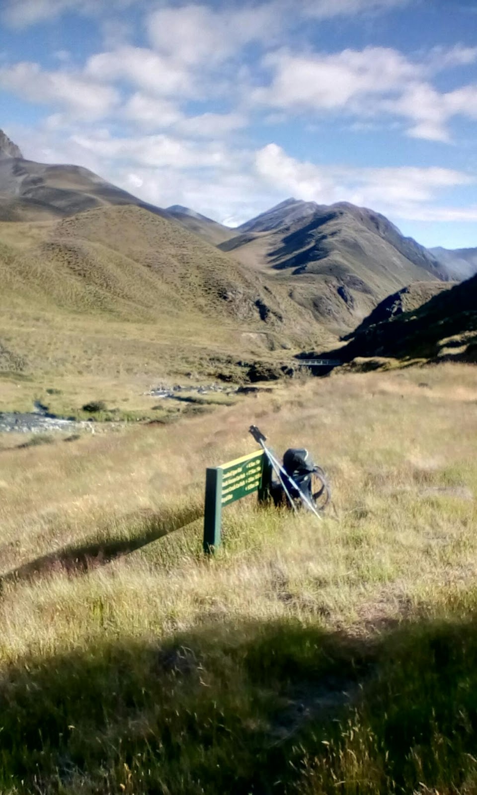
Along the way I managed to get lost twice. The first time I had to retrace my steps by 750m (the worst instance of this on the trail so far!) Then at the second I looked at a map, found an alternate route that didn't involve backtracking and just carried on.

It was also in this period that I came across this day's trail foraging treat: tons of plums! There were at least three varieties, some tiny ones the size of cherries (these were super sweet and I ate 30 or 40 of them), prune plums (not quite ripe yet), and some larger red ones with nice free stones (I restrained myself to maybe 20 of these.)

Once in Frankton the trail pleasantly followed the lakeshore into Queenstown.

It had been a few years since I'd been in Queenstown  and, unsurprisingly the tourist madness had continued to grow exponentially (though I think they've actually done a pretty good job of making it remain an appealing place while this has been going on.)

While waiting to check in to my hostel I walked around a lot, went for a swim in the lake (pleasantly warm, rather to my astonishment) and had a beer and a huge bowl of pulled pork and cheese fries at the craft beer bar across the street.

The afternoon (once again, referring to times after 14:00) was spent inside fixing my shoes, planning the final leg of the journey (pretty much 90% finished!) etc.

Now that it's grown a bit cooler I may venture out again and see what Queenstown in the evening is like...

Te Araroa Day 93, Wanaka to Highland Creek Hut

Starting km: 2620
Finishing km: 2650
km covered today: 30

In addition to the (single) beer, the other treat I'd granted myself for the night in Wanaka was to not set an alarm. Not a bad thing, give that I was woken up by roommates returning in the wee hours.

And as this was (for once) not a monstrously long day, it didn't even matter that I woke up at 8:45.

Pack up, then on to an easy stroll along the lake shore. Somehow I managed to get lost while doing this (how do you get lost walking along the shore of a lake!?) But when I discovered this, it just meant that I walked along the (also fairly nice) road til it rejoined the trail.

It did this at the Glendhu Holiday Park. At which the surroundings were nice, but were shared with, at a guess, 2000 other campers in the ~1km long bit of shore it occupied, all of them in huge tents, caravans or both. "Who on Earth finds this pleasant?" I thought as I walked past. But then I imagine many people would ask the same question about what I'm doing.

From there it was on to the Motatapu Track. Constructed in 2008 as a condition of the sale of Motatapu Station to foreign owners (Shania Twain and her then husband), it parallels the Crown Ranges Road, which I've always  thought is one of the coolest bits of  road in the country.  It's also reputed to be a pretty tough bloody walk, so I was curious to see how my cold-weakend body would handle it.

The first stretch was supposed to be the easiest, and really was quite pleasant. Yes, it included a 400m climb, but this was mostly through cool and pretty forest so was not unpleasant.

Popping out of the bush, I arrived at the Fern Burn (burn as in the Scots word for stream; we're in Otago now) and got on to the next bit, which was meant to be more typical of the track. A long climb up to a 1260m saddle was managed with minimal trouble.  On the way up you could see Lake Wanaka back down the valley and at the top, some of the landscape to come.  I'd read some trail notes describing it as "broken" and now understood what they meant. Lots of steep cliffs, exposed rock, and hardly a ridge anywhere that continued unbroken for any significant length of time.  This did look like tough walking country.

But 30 minutes of steep descent and another 40 of upping and downing and sidling through that broken landscape and I was at the Highland Creek Hut.  In quite good time indeed.  The trail notes had said it ought to take 7 hours. I'd made it in just over 4. So I guess I was dealing pretty well with the cold.

I was sharing the 12 bunk hut with four others, meaning that there was plenty of time and room to enjoy the rest of the afternoon, reading, writing  cooking and chatting. (Interesting note: for only the third time since starting TA, Kiwis were again a majority in the hut.)

Thursday 25 January 2018

Te Araroa Day 92, Stody's Hut to Wanaka

Starting km: 2573
Finishing km: 2620
km covered today: 47
I woke up planning to have a relatively easy day. But the best laid plans never survive contact with the trail, and by the time I'd made it to the summit of Breast Hill and finished the first leg of the day I'd decided that maybe it'd be a good plan to go all the way to Wanaka. (This was based partly on the desire for a shower and real food and partly on the fact that it would then be able to make it to Queenstown in two days instead of three.)
So after mountain-goating my way down the steep and tricky trail to Lake Hawea I called up a few Wanaka backpackers and eventually the i-site who claimed (quite believably) to have found me the last dorm bed in town.
The walk to Wanaka was pleasant and relatively easy (compared to the beast of the previous day). It followed along the shore of Lake Hawea (which, I think may be to Wanaka what Wanaka is to Queenstown), then the Hawea River, then the shore of Lake Wanaka.
I actually arrived at before 17:00, so even managed to pop into the DOC office to chat a bit about the next segment of the walk.  This provided an illustration of how much Wanaka has grown in the six or seven years since I was last there. Back then the DOC office was kind of on its own and the last building on the way out of town. Now it's firmly in town, entirely surrounded by houses.
The hostel I was staying at was a bit institutional, but was pretty clean and had awesome commercial gas stoves in the kitchen (on which I cooked up another one of my 1kg mixed frozen veggie specials.)
On the down side it was alcohol free, which meant I had to walk down to the beach to drink my beer (I'm not sure whether the dry policy was primarily to force guests to drink at the on-site bar so that the owners make more money or to force guests to drink at the on-site bar so that they're not annoying other guests by drinking in the hostel [just annoying them when the bar closes.])
Since this has been a pretty short entry I'll include a few photos of gear that is struggling to make it to the end of the trail: holey, multiply repaired shirt; bent (and getting more bent) trekking pole; shoes with soles that have been glued back on in spots and cut away in others; socks that can't really even be called socks anymore.

Wednesday 24 January 2018

Te Araroa Day 94, Highland Creek Hut to Eichardt's Flat

Starting km: 2650
Finishing km: 2680
km covered today: 30
This was supposed to be the toughest day of the Motatapu, a rough track. So I was on the trail by 7:00, chugging my way up a steep spur and into the low clouds.
When views out over the mountains or down into the valleys did emerge they were lovely. Continuing very big, and still quite "broken."
The track went down into a section o forest, then right back up another 500m. By this time the cloud had thinned, and the land was looking (a little bit) friendlier.  I also had a good solid feed of snow and snow totara berries in here.
Unsurprisingly given the landscape, the track went back down yet again to the Roses Hut.  There were plenty of signs at the bottom directing walkers along the trail and firmly reminding them that the road (presumably up to Shania's former home) was private with no public access.
I'd arrived at Rose's Hut at 11:15. This gave me a ton of time to make it to my next destination, Macetown.  I'd been warned about sandflies there, so decided to spend my lazing time at Rose's instead. I took a four hour lunch break during which I cooked lunch (a rarity), read my book and Federated Mountain Club Bulletins, dried my (dew-moistened) gear and even contemplated having a nap.
Around 15:30 I got going again and charged up the final of four 500m climbs on the track. The views from the top were of more tremendously rugged peaks. I stopped for a while because this really and truly was my farewell to mountains on Te Araroa. The trail only goes above 1000m once more, and that to a peak rather than a pass. So this was really goodbye. I would miss them. The scenery was invariably lovely, and at my present fitness levels the work usually wasn't even particularly hard.  Better than that bloody pasture-walking (of which, sadly, there is more to come.)
Down in the valley I had another final: my last river walk. Strolling down the Arrow was a lot of fun, especially since the flow was low and the riverbed was more stable and less slippery than many other rivers I'd walked.
It was in the section between Rose's and Macetown that I saw all of my northbound TA walkers for the day. There were six in total. I'd been seeing five or six a day for quite a while now, which leads me to wonder if the typical 80/20 (or so) split of SOBO to NOBO walkers may be different this year.
I got to Macetown at 17:30 or so and was, as promised, accosted by sandflies. Plus the sun had cooled down, and I was enjoying my walk. As so often happens I decided to just carry on and see where I got to.
The going was slowed a bit, but pleasantly so.  First by a few raspberries. Then by the sweetest white and red currants I'd ever tasted. Then by tons of gooseberries. And finally by Big Hill  (this is not one of my cute little descriptions like "A flat piece of ground somewhere near..." It's the actual name of the hill) Saddle where I could call Sarah and send a couple of emails.
I ended up on Eichardt's Flat. Like a lot of the land around Arrowtown it was covenanted as public access, but owned by a trust. There was nothing in the trail notes saying not to camp there, nor on the comprehensive signs at the entrances and trail junctions.
Since it was a lovely evening, and I'd seen a new weather forecast saying it would be a lovely morning I decided to forego the tent and sleep under the stars. I was rewarded by a brilliant meteor (easily visible despite the gibbous moon nearby, and probably brighter than Venus) and a very pleasant night's sleep.

Tuesday 23 January 2018

Te Araroa Day 91, East Ahuriri River Valley to Stody's Hut

Starting km: 2531
Finishing km: 2573
km covered today: 42

Whew, that was a big day. After spending so much of the last entry talking about how great I am and how easy this stuff is for me, I guess it's appropriate that I tested myself the next day.  And I passed, albeit not with a whole lot of fuel left in the tank.

It was an easy morning, with a 5km cruise down to the Ahuriri River through wide open plains that showed almost no life other than the multitudinous rabbits that had denuded them.

The Ahuriri was slightly more than knee deep and fast flowing but warm.  A nice way to greet the sun, which was just starting to get its head above the mountains behind me.

From there the walk was an easy flow climb through a working farm. The only particularly interesting or difficult bit was walking a ways up s hill and climbing over a fence to avoid disturbing a very pregnant cow that was hanging out in front of the gate.

Things got a bit tougher when the track turned right and headed up towards Margaret Saddle. Though as it was an ex farm vehicle track it obviously couldn't have been that hard.  I doubt you could drive up it now though, as it was covered by what looked almost like shattered rock in some places. These were some highly weathered mountains.

The wind was really howling on top of the saddle, which was to be expected. This meant that I didn't spend long on the top, which is kind of sad, as with the possible exception of some bits of the Motatapu track still to come, the 1680m Margaret may be the last big mountain pass of TA.

From there it was more farm track, even windier and even more rock shard-covered, down to the Top Timaru Hut.

After a late lunch there was when things started to get a bit tough. The section to the next trail junction was meant to be 11km and take 5-6 hours. These estimates are always conservative, but 2km/h is a bit of a warning sign.

The first bit was hard work but fun. Lots of up and down, dancing along narrow tracks as they sidled along in the recently reentered forest.  Then a quick crossing of the river, then more of the same.

I was having fun with this, but next time decided to follow the river instead of leaving it when the track did.  A northbound (NOBO in thru-hiker speak) walker I'd met said it was possible to go almost all the way to the track junction this way.

And indeed it was. I'm not convinced it was much faster, and with all the scrambling to get around deep pools it probably wasn't any easier. But it was definitely cooler and more fun.

3.5 hours of scrambling up and down the be-bouldered banks of and splashing through the river and it was time to rejoin the track. Just in time for 2kms of climbing at a 25% grade. Normally this wouldn't be that much trouble, but I'd already done 40km, so it was a real slog.  I was certainly feeling some pain in my knees and tiredness in my whole body and legs in particular at this point.  "See what hubris gets you," I thought to myself, remembering the previous 'blog entry.

Up at the top, the four residents of the six-bunk Stody's Hut were welcoming, even if the hut itself was rather... rustic let's say (dirt floor, warning in the hut book about the resident rat...)

That night I woke up around 2 with a sore throat and realized that I'd caught a cold from the nice English woman in the next bunk in Tekapo who had loaned me needle and thread to repair my shirt. So maybe it wasn't just my hubris that had made the 13 hours of walking so tough.

Monday 22 January 2018

Te Araroa Day 90, Twizel to East Ahuriri River Valley

Starting km: 2477
Finishing km: 2531
km covered today: 54
Same number of kilometres as the previous one, but a rather different day of walking. Incidentally, I seem to have a thing about 54km days. I've had four of them now and they've come in two sets of two.
I got up early, but the rowers had me beat, finishing their breakfast as I started mine.
As with the previous day, much of the morning was spent walking on the Alps to Ocean cycleway. Unlike the previous day, most of it was actual trail rather than actively used or disused road, so it was easier on the feet.
The A2O (as they call it) was getting a lot of use, and I enjoyed the quick chats with the cyclists as they rode by.
I also enjoyed the rain! It drizzled and as I approached Lake Ohau Village briefly got a bit harder. But it never really poured, and it was warm out, so it was far preferable to yesterday's heat and fierce sun. It didn't do much for the scenery, but still...
The kilometres that had somehow vanished from the Tekapo to Twizel segment seemed to have reappeared in the Twizel to Ohau section. But between the nice track and the good walking weather, the first 33km went by very quickly. So the morning (by which I apparently mean the period of the day between 06:30 and 14:00) was good.
The afternoon was even better. It consisted of a walk up a beech forest valley (how times change. Ten days before I would have groaned at the prospect of more beech forest, but after the morning rain the sun came out, so it was both different and shady) followed by a climb up to an unnamed saddle through the tussock with minor but pretty peaks nearby.  And through all of this I just enjoyed myself. My schedule for the segment meant I needed a longish day, but exactly how long didn't matter, and I wasn't in a rush to be anywhere (unlike yesterday when I needed to get to town before the 4 Square [supermarket] closed).  So I could just walk until I felt like I'd had enough or until it got dark, whichever came first.
They came pretty close to coinciding. The walk down from the saddle into the East Ahuriri Valley was pleasant and easy. A gentle downhill, with the few crossings of the river being easily rock-hoppable.  So I just kept going until I found a (really) nice campsite some 6km from the end of the trail.
From Ohau Village to now, parked up in my tent I didn't see a soul. The closest I came to people was a few rabbits.  Ahh, solitude.
Before closing, I'll relate a little conversation Karsten (fellow TA walker) and I had last night. He was amazed by how far I'd walked from Tekapo (he'd done the same distance, but had rented a bike for it). I told him that I just seem to be made for this. And it's kind of true. I've played a few sports (rugby, middle distance track) but have never been any better than average at any of them (my goal in track was always to not finish last.) But long distance hiking does seem to be something I'm particularly good at. Not that it's (meant to be) competitive, but I've always enjoyed really pushing myself and having long days while tramping, hearing surprise in hut-mates voices when I tell them where I've come from that day, etc. and Te Araroa seems to be the ultimate expression of this.

One final thing to mention that I forgot to a couple of days ago: on one of my off trail adventures between Camp Stream and Tekapo, I saw a wallaby! I still wasn't absolutely, 100% sure that my friend who told me they live down here wasn't joking, but now I can confirm that yes, there are wallabies in NZ.


Sunday 21 January 2018

Te Araroa Day 89, Lake Tekapo Village to Twizel

Starting km: 2423
Finishing km: 2477
km covered today: 54

As common with many of my long walking days, this one wasn't planned. I set out at 7:15 for The Pines campground, 47km distant. But after a bit of easy walking along the Tekapo Canal I realized that it was 47km from the very farthest end of Tekapo and that I was about 5km closer. That made the walk to Twizel 5km more manageable, so I thought "what the heck," and phoned to reserve a room at a backpackers there.

Other than the scenery and the heat the walk was positively North Island-esque. It was mostly road walking of a sort, though much of this was along the Tekapo Canal and was closed to vehicle traffic (there was a big salmon farm in the canal, which was also a popular fishing spot, presumably for some of the escapees, such as the 50cm fellow I saw jump out of the water.)

The whole day was filled with views of Mount Cook over turquoise bodies of water. It's an impressive mountain and I was certainly familiar with it from every angle.

One of the less positive point of the day was that it was quite hot with few places to get water except for down the long and/or steep lake or canal banks.  This made the apple trees I spotted along the trail even better. Objectively they weren't great eating apples. Quite tart, a big dry and rather tannin-y (they'd probably make good cider) but I thought they were divine and ate eight of them.

Speaking of eating, when I finished my day's stroll through the hot, dry McKenzie basin I arrived in Twizel and cooked myself another monster dinner. 1kg of veggies, 300g of corn chips, and a huge bowl of ice cream that was leftover from the girls' school rowing team staying at the same place (I'm actually a bit surprised by that... If there's anyone who can compete in the eating game with long distance hikers, surely it's growing rowers?)

Anyhow, it's all good fuel for the coming days walks. Doing some extra km today has got me thinking of pushing a bit harder in coming days too and maybe getting to Wanaka a day early.

Saturday 20 January 2018

Te Araroa Day 87, Crooked Spur Hut to Camp Stream Hut

Starting km: 2259
Finishing km: 2389
km covered today: 30
This day seemed to zip by, despite my being on the trail for over 12 hours.
In the morning I headed from the busy Crooked Spur Hut (9 occupants, 8 bunks... I'd played Hearts with a group of Kiwis and one American the night before) to the empty (or so the hut book told me) Stone Hut.  This walk really did feel almost lonely. Just me in a very big, very sparse landscape. Well, me and a couple of kea flying above and a big herd of Tahr.
The walk was lots of climbing and descent, but I've got pretty good at that.  And at anticipating where the trail is likely to go when the markers are spaced too far apart to see easily, another skill that came in handy more than once on this day.
Just before arriving at the hut, I found a big patch of snowberries and had a second breakfast of them. They look and taste quite a bit like blueberries (except for their being white, of course.)
The 5.5km on to Royal Hut (so re-named after Prince Charles and Princess Anne visited it) was frustrating. The tussock and Spaniard and speargrass was getting very big and I often couldn't find the previously used path between the marker poles and had to push/stomp/bash my way though it.  But the sunny, solitary morning tea stop at the beautifully sited hut was worth it.
After morning tea came time for the day's main action, the climb up to Stag Saddle.  At 1925m it's the highest point on Te Araroa.  The marker poles were once again far apart, but there weren't too many places the trail could plausibly go, so my guesses usually proved right or at least right enough.  And as I mentioned before the climbing wasn't a big deal, even at an elevation where thinner air starts to make a difference.
Up on top of the saddle I met a group of TA section walking Kiwis headed the other way. We took the obligatory photos, but were actually all rather engrossed in our phones. There was supposed to be reception on top of the saddle and I hadn't talked to Sarah in a while, and I hoped to pre-book a bed in Tekapo for the next night as I remembered being stuck without accommodation there in the past at this time of year.
None of this really worked, but I at least got a text off to Sarah saying "hello, I'm okay, could you please book me a bed at this place in Tekapo, I'll call you from there." (As it turned out I actually got to talk to her later in the day from a spot further down.)
Down from the saddle their was a choice, the valley route or the ridge route. The latter purportedly had nice views, but could only be done in good weather and required a bit of navigation.  Fortunately it was sunny, with hardly any wind, even on top of a 2000m pass. So the ridge it was.  And wow, what views! Ahead, teal blue Lake Tekapo from above. Behind, Mount Cook and all of the other grandest glaciated, snow capped peaks of the Southern Alps.
I sat myself down on a rock for a 90 minute lunch, which is pretty exceptional given that I usually think half an hour is a long break.
The views continued pretty much all the way down the ridge, and when it eventually ran out I was within spitting distance of the Camp Stream Hut. There was only one other TA walker named Karsten there, but it was a very old hut and super hot inside, so I actually decided to set my tent up instead.
Later in the evening two women showed up. They worked in Tekapo and were just out for an overnight tramp. They'd carried up two (glass) bottles of wine and six beers, not to mention all sorts of food that looked profligately heavy to Karsten and I. None of this was unreasonable for an overnight tramp of course. Just a  funny illustration of how time on the trail can change your perspective.