Tuesday 31 October 2017

Te Araroa Day 8, Puketi to Pahia

Starting km: 199
Finishing km:248
km walked today: 49
You can already tell that this was a huge day's walking.  But why?
Well, after we parted ways in Ahipara, Sarah was going to have a little holiday in the Bay of Islands region before heading back to Wellington.  We'd been talking the day before and discovered that while she was meant to be heading back to Wellington this morning:
A. I was getting very near the BoI and
B. There were $35 flights back to Wellington for the next day

So Sarah changed her plans and I busted my butt walking for a day so we'd get to see one another again.  Yay!
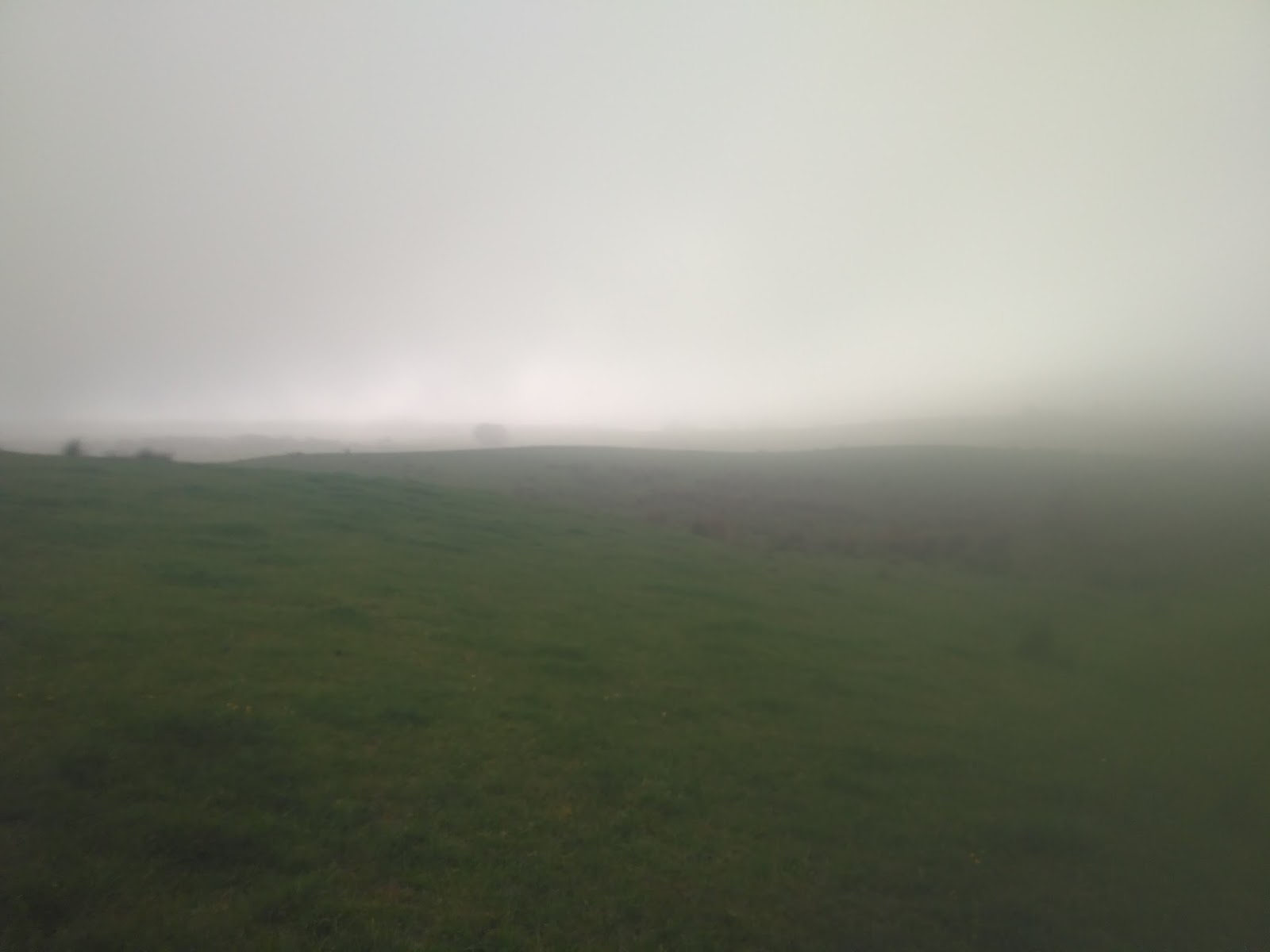
The day was mostly pretty nice, but started out with fog and rain.  This made the beginning of the walk through farmland tough to navigate (hard to see the marker posts) and tough on the feet (my shoes and socks got soaked, so I changed to sandals, which promptly got filled and covered in grass seed.)  I met lots of nice sheep though.
This was somewhat mitigated by the lovely folks who set out a bucket of grapefruit and beer (too early, even for me) as the trail passed into their farm.  Double trail-angels, allowing public access to their land and providing treats for walkers!

By late morning I was at the Kerikeri River trail, which was very pretty, very well constructed and maintained, AND shared with lots of non-TA hikers
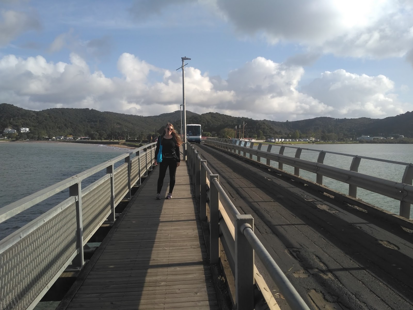
Following a good long walk though Kerikeri and a pine plantation, I met Sarah just outside the Waitangi Treaty grounds.  It was so great to see her and have a big hug after a long day.  I felt a little bit guilty when she offered to carry my pack for the last ~3km, but not guilty enough to say no.  Starting the day with wet feet that kept damp all day had led to my first (small) blister of the trip, and after 45km I was pretty tired

Bliss!  A big steak on the bbq, a big salad a bottle of wine, an actual bed and someone to snuggle up with in Pahia

Sarah had an early bus the next morning, but I hung about in Pahia, finishing off my re-supply shopping and having a tiny bit of a (gasp!) rest day

Monday 30 October 2017

Te Araroa Day 7, Omahuta and Puketi Forests

Starting km: 174
Finishing km: 199
km walked today: 25

The final two Northland forests, Omahuta and Puketi are really combined as you walk straight through them both at once.  They were nowhere near as difficult as Raetea (or even Herekino!)

While it is important to help prevent the spread of Kauri dieback, there's really only so much boot cleaning one can do without running water.  This morning I stopped to give myself the rare treat of a cooked breakfast and to clean off my shoes from the previous day's mudbath

My feet got plenty wet this day, but in a welcome relief after Raetea and Herekino, there was almost no mud!  The day began with a walk down through a pine forest to a stream.  Upon reaching the stream, walkers spent a few km walking downstream through the water, popping out on to the banks to avoid deep pools.  This walking, splashing, etc. was genuinely FUN!

Following the stream walk, there was a tough, slippery sidle along a riverbank, followed by a long climb up a ridge (which happened to be covered in the largest collection of medium-large kauri I'd ever seen in one place.)  In between the two I stopped for a swim in a deep pool near the river's headwaters.  Unlike a lot of the snow/glacier fed rivers elsewhere in NZ, this one was pleasantly cool rather than bloody freezing!

After the big climb, the day finished with 9km along a (not accessible to vehicles) gravel road.  I spent the night at a DOC campsite that was accessible to vehicles and full of overnight campers (as opposed to the previous few days, where I'd camped with either no one, or a small collection of fellow TA walkers.)

Sunday 29 October 2017

Te Araroa Day 6, Raetea Forest

Starting km: 136
Finishing km: 174
km walked today: 38

The muddy Herekino was only the first of the three testing Northland forests.  I mentioned in the last post that I hadn't found it that tough.  Forest #2, the Raetea was a much more challenging beast.  Just as much mud as Herekino, lots more up and down and plenty of downed trees and other impediments to navigation.

I woke really early (before 6) in an attempt to make it through the forest quickly, but my marginal fitness and all of the mud made even the modest 400m climbs of the Ratea tough.  This was made worse by the fact that near the high point of the day I lost the trail, then after re-finding it walked the wrong way for 15 minutes (I couldn't figure out why there was so much uphill after I'd supposedly reached the high point!)

All of this combined with low blood sugar from not having eaten enough for dinner the previous night or breakfast, leading to a slow and miserable time through the slippery downhills leading out of the forest.

My legs were COVERED in mud by the end of the forest, both from deep mud on the trail and slips and falls (my trekking poles saved me from having many more of these, but I managed to slightly bend one in the process.)

After leaving the forest, I still had something like 12km of road walking to do to get to my afternoon's destination, the dairy (and takeaway food stop!) in the town of Mangamuka.  I really pushed as hard as I could and made it at 14:50, 10 minutes before it closed for the day (it was a Sunday.

I stocked up on a few supplies and enjoyed a big bacon-egg burger, fries and a cold pop at the Mangamuka dairy.  I felt a bit guilty as the six TA walkers I'd passed during the day trickled in, watching me finish my meal but unable to get one themselves.

I forgot to take a screenshot of my campsite on the day.  It was at the "camp" shown above.  As usual, I did another good chunk of road walking through pasture and the beginnings of a conservation area after the dairy but before settling down for the night.  On this particular evening I had my tent all set up  when I had a read of the trail notes and read that DOC had requested only stay in one of two official campsites in the Omahuta and Puketi forests (I'd thought the restriction applied to Omahuta only.)  But by this time I was in bed and it was dark out, so there was little for it but to stick where I was for the night.

Saturday 28 October 2017

Te Araroa Day 5, Herekino Forest

Starting km: 101
Finishing km: 136
km walked today: 35

After taking Sarah to get her bus to Pahia, Brian dropped me off in Ahipara where we'd finished walking the day before.  It was a bit further to the start of the forest walking than I'd figured, but it was at least a pleasant 5km

The walk through the Herekino forest brought my first big kauri tree of northland (as well as my first boot cleaning station, placed there by the NZ Department of Conservation [DOC] in order to help prevent the spread of kauri dieback disease).

While the kauris were cool, the thing that the Herekino Forest is best known for is mud on the trails.  It hadn't rained for four days, but I still spent a good chunk of the day walking through ankle deep mud (though there was also some nice easy walking on old forestry roads.)  The Northland forests have a reputation as being the first big test on Te Araroa, and possibly the hardest part of the north island.  I actually didn't find Herekino that bad, getting through it in 5.5 hours as compared to the 8 listed on the sign at the entrance.

There was a nice looking privately constructed hut and camp just at the exit to the forest, and the offer from a local to camp out behind the hall in the town of Takahue, I ended up picking a nice grassy spot by the river (also suggested by a local, who stopped his car to offer me the recommendation) a full 15km of roadwalking past the end of the Herekino

Friday 27 October 2017

Te Araroa Day 4, 90 Mile Beach

Starting km: 70
Finishing km: 101
km walked today: 31

Day 4 of the walk was our third day on 90 Mile Beach.  I really enjoyed having Sarah's company, as this day was as tedious as the previous one on the beach (if a bit easier because we knew it was the final one on the beach.)

We were the second to depart for yet another sunny day's stroll on the beach (don't forget to sunscreen your ears and neck... You're getting it out of the sky, off the water and off the sand)

Incidentally, walking on the beach sounds easy, but is tougher than you'd think.  You have a choice of walking on concrete-hard wet sand or soft dry sand (unless it's high tide, in which case you only get the soft stuff.)

Wet sand is very hard on the feet once you've gone more than about a km (even moreso if you give in to temptation and walk barefoot) and dry sand is just plain difficult to walk in, really taxing your leg muscles.  30+km of this stuff in a day is hard work either way!


Super proud of both Sarah and myself for finishing the monster beach walk. Especially after I promised we'd get a coffee/ice cream at the one tiny settlement we passed on day 4, only to discover they had neither.  Then adding insult to injury we walked an extra 1.6km after the end of the beach so we could wait at a cafe while Brian came to pick us up from the coastal town of Ahipara to return to Kaitaia for the night, but found the cafe closed when we got there!
Brian picked us up from Ahipara and brought us back to Kaitaia for the night.  We both had sore feet (though I was completely blister free!)   


Back in Kaitaia I did a bit of re-supply shopping for the upcoming days' walk and we had a lovely dinner out.  The fish was super-fresh, but the salad bar was maybe even better.  Not having had much in the way of fresh veggies on the trail I kind of overdid it...

Thursday 26 October 2017

Te Araroa Day 3, 90 Mile Beach

Starting km: 40
Finishing km: 70
km walked today:30

If Day 2 was one of getting excited to be walking along a never-ending ribbon of sand, Day 3 was one to get bored of it.  There weren't even any landmarks to pay attention to.  Sarah and I spent most of the day waving to the occasional vehicle driving on the beach (infrequent after the morning's first few tour buses) and counting/saying hello to the various birds (gulls, oystercatchers, terns, dotrells) that kept us company along the coast.

Looking back up the beach

This, the coming and going of the tide throughout the day, and the various flotsam and jetsam (little blue jellyfish, TONS of small jelly-like creatures that were either salps or comb-jellies) were about all there was to entertain.  Indeed, at the end of the day when we reached the camp we were talking with fellow walkers about specific pieces of driftwood we'd seen over the 30km day's walk!

Speaking of Camp, we spent the night at the lovely Utea Park with several other TA walkers (including one woman who had missed the previous camp and walked 55km to Utea!) and enjoying the hot showers, fresh water, kitchen facilities and hospitality of the lovely Tania.

Finishing spot on Day 3, the wonderful and home-y Utea Park


Wednesday 25 October 2017

Te Araroa Day 2, 90 Mile Beach

Starting km: 13
Finishing km: 40
km walked today: 27

The morning of Day 2 began with a walk up and over a rocky point before headed down to Ninety Mile Beach, where we'd be spending the next three days.
Spending the whole day on the beach began to give you some idea of the scale of place.  There were two landmarks that we kept seeing all day, first an island, and second the rocky spit of Maunganui Bluff.  These illustrated how deceptive walking on the beach can be.  They'd often be much further away than they looked (that can't be 12km away!?), never seeming to grow any nearer no matter how long we walked.

The view down to 90 Mile Beach in the morning (named before it was properly measured, 90 Mile Beach is actually just over 90km long.)

The sunset over Maunganui Bluff

And behind the dunes, our home for the evening
Campsite at the end of Day 2, Maunganui Bluff.  The camp wasn't flashy, and the water needed filtering, but there was flat, grassy ground and even a shelter to cook in!


Tuesday 24 October 2017

Te Araroa Day 1, Cape Reinga to Twilight Camp

Starting km: 0
Finishing km: 13
km walked today: 13

Day 1 began hitchhiking up to the Cape.  It went really smoothly.  The first ride was with a local lady headed home after some shopping in Kaitaia.  The second (we hadn't even had time to put on sunscreen before she pulled over!) was an American tourist headed up to Cape Reinga.  Thanks ladies!

Cape Reinga isn't actually quite the northernmost point in NZ.  But is is the northernmost publicly accessible point, and it certainly has an "end of the world" feel to it.  In addition, it is a special place in Maori tradition, being the place where the spirits of the dead leave the world to return to the homes of their ancestors.

The Official Starting Photo
The views out over Cape Maria Van Diemen headed south from Cape Reinga were beautiful
Headed down from the cape to start the walk

The coastline to the south was wild and gorgeous, and the walking was generally simple.  It was a steep descent down from the cape, then a bit of a wait while the tide went out enough for us to get past a rocky point, but was finished off with a pleasant 10km or so along the beach to the Twilight Campsite.

Setting out from the Cape on Day 1!
Twilight Camp, Our camp location at the end of the day

Monday 23 October 2017

Te Araroa Day 0, Getting to Kaitaia

Te Araroa begins at Cape Reinga, way up in the far north of the country, a long way from home in Wellington.

My partner Sarah was joining me for the first portion of the walk, and following a weekend at one of our favourite Wellington beer festivals, the plan was to fly up to Kaitaia, the northernmost airport and sizeable town in the country.

The first flight, Auckland-Wellingon went off without a hitch.
Sarah and I Enjoying our traditional Auckland airport beer while waiting for our flight to Kaitaia
The second one, however had some troubles.  Our plane was late arriving from Kaitaia.  We finally got aboard and after the quick flight (about 45 mins), attempted to land.  And failed due to low cloud over the airport.  And tried again.  And failed again.  And tried again.  And failed again.  At this point we had to turn around and fly back to Auckland.  When we got there, some 3 hours after departure, we were given the option of taking the same flight the next day or going up the following morning at 04:45.
We opted for the latter, with a few hours sleep in the Auckland airport hotel beforehand.

The next morning was bright and clear, and we made it to Kaitaia with no trouble.  True, the airport shuttle wasn't there to meet us as planned, but one of our fellow passengers kindly offered us a ride into town (and even bought us a coffee as we waited for the supermarket to open so we could buy our walking supplies!)

Sarah looking radiant aboard our early morning flight to Kaitaia.
We did our shopping, made a quick stop in town to visit Brian, the Airbnb host who we'd planned to stay with the previous night and who we would be staying with when we'd walked back down the peninsula in a few days time.

After this it was northward ho.

Friday 20 October 2017

Te Araroa Introduction

Hi everyone! My name's Llew.

This 'blog will document (at least loosely) my walk of Te Araroa (the Long Pathway) a trail that runs roughly 3000km along the full length of New Zealand.

I'm setting out from Cape Reinga at the north end of the country in late October, 2017 and hoping to reach Bluff at the southern end of the south island four or five months later.

The general plan for the blog is to give a day by day summary of the walk, with a wee description of each day's walk and a few photos from the day as well.

Enjoy!